The Event Organizer feature allows you to export the event maps to PDF files.
The exported PDF files can be edited using PDF editing applications. You can move the control numbers or add titles to the map. You may not delete the source notification.
PDF files of the maps may be printed, distributed to event participants, or uploaded to NaviTabi and made available to users.(有料コースの設置)
In order to create PDF files, you must have a paid subscription or have paid the per event upgrade fee. Previewing of PDF files is available for free.
Wi-Fi environment is recommended when creating the PDF files as there is some data network usage
Features and functions
- Print Area
- Scroll the map to set the print area.
- Print area size is fixed automatically by the paper size and the scale.
- Course
- Choose the course you want to print on the PDF file.
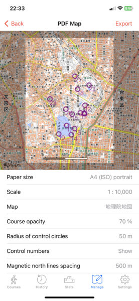
- Paper Size
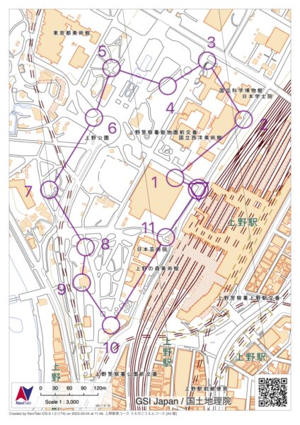
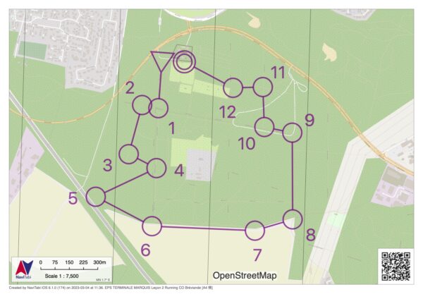
- Choose from A3, A4, B4, or B5
- Choose from Landscape or Portrait
- Scale
- Choose from 1:3,000 to 1:50,000
- Map
- Choose your base map
- Chiri-in Zu (Only in Japan)
- OpenStreetMap
- Choose your base map
- Opacity of Course
- Choose the opacity of the course.
- Choosing 0% hides the course completely.
- Radius of Control Circles
- Choose the Control Circle radius from the following:
- 120m, 80m, 50m, 30m, 18m, 10m
- Choose the Control Circle radius from the following:
- Control Number
- Choose to show or not show the control number.
- Move the numbers using PDF editing applications.
- Magnetic North Lines Spacing
- Choose whether to show magnetic north lines or not.
- When showing the magnet north lines, spacings from 100m to 1,000m can be chosen.
- Magnet North Lines are based on World Magnetic Model (WMM2020).
Sample Image of PDF map